

 GROUND BREAKING

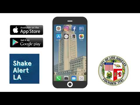
Released quietly last New Year’s Eve after many months of testing, ShakeAlertLA, the country’s first earthquake early warning phone app, is the latest in the City’s quest to bring modern technology into the everyday lives of Angelenos. The City is taking to it in a big way, with nearly half a million downloads (and counting) so far.
 ShakeAlertLA gives users at least seconds, maybe more, of warning before the user feels the shaking of an earthquake (of 5.0 on the Richter scale and above) while it’s happening. The farther away the earthquake’s epicenter, the more seconds in advance of it the app will alert you it’s coming. It utilizes the extensive sensor network on the West Coast developed by the federal government’s U.S. Geological Survey.
Long a directive of Mayor Eric Garcetti, the ITA team built the app’s front end, managed the building of the back end (by AT&T), coordinated the assembly, extensive testing and final posting of the app, which is available for Apple and Android phones, in both English and Spanish.
Members of the team from ITA and the Mayor’s Office spoke to Alive! about the app and how it was built.
The app also includes information about how to prepare for an earthquake, details on recent earthquakes, and how to find help after an earthquake.
Collaborative Partnership
The ShakeAlertLA App is brought to you by the Office of Mayor Eric Garcetti, and the Information Technology Agency and the Dept. of Emergency Management. It’s made possible by support from the Annenberg Foundation and the Mayor’s Fund for Los Angeles. The app is an official pilot in partnership with the U.S. Geological Survey.

How It Works
When an earthquake happens, a rupturing fault sends out different types of waves. The first wave felt is the fast-moving P-wave. The slower-moving S-waves arrive later, causing the most damage. Sensors detect the P-wave and immediately transmit data to an earthquake alert center, where the location and size of the quake are determined and updated as more data become available. A message from the alert center is immediately transmitted to your computer or mobile phone with data on the expected intensity and arrival time of shaking at your location.
To receive notifications of earthquakes once you have downloaded the app, you must have Location Services “Always On.” As a result, ShakeAlertLA keeps track of the last location of your phone to push out an alert as needed with the expected shaking at that location. When the location is updated, previous information is overwritten. No other information is collected or accessed.
Here and on the Alive! Website, read about the ITA/Mayor’s Office team that built the groundbreaking new app, how they did it, and why it matters.
The Alive! Interview
Technology to Save Lives
On Feb. 12, Club CEO John Hawkins and Alive! editor John Burnes interviewed project lead, Jeanne Holm, Sr. Technology Adviser to Mayor Garcetti and Deputy CIO, ITA, Club Member, 3 years of City service; Maryam Abbassi Information Systems Manager II, ITA, Club Member, 23 years; and Marissa Aho, Chief Resilience Officer, Mayor’s Office of Public Safety, 4 years. The interview took place in an ITA conference room in City Hall East; Jeanne called in by phone.
 |
 |
 |
First of all, thank you for joining us today. This app development is very exciting, and we’re glad we can explore a behind-the-scenes of the City employees who made it happen.
So, generally, what is this app? We’ve all seen it in the news, and of course we’ve downloaded it. But tell us about it in your own words.
MARISSA AHO: Sure. ShakeAlertLA is an earthquake early warning app. It’s the first app that’s been publicly released in this country, and it has been a passion for this team and Mayor Garcetti for a number of years. It’s to warn residents of Los Angeles County of a coming earthquake as soon as possible.
The City has been testing earthquake early warning in beta with the U.S. Geological Survey since about 2012. The City invested nearly $6 million in the sensor network that’s in Southern California for earthquake early warning. In April 2017 in his State of the City address, Mayor Garcetti said that we would have earthquake early warning out to Angelenos by the end of 2018. We put a lot of hard work into working with USGS and getting that done.
The app is the first or second of many opportunities to get earthquake early warning into the hands of Angelenos, but it was a year-long effort to produce something that could be on cell phones and was public to anybody in LA County.

Who owns the sensor network?
MARISSA: It’s a U.S. Geological Survey sensor network. The U.S. government.
How was it determined that an app would be the best way to get the information to the public, and then how was it built?
JEANNE HOLM: We use a couple of different ways of getting this information out, not just the app. One of the projects we’ve been doing is linked to the loudspeakers and the public announcement system in City Hall.
You don’t have to have only an app. We want to be able to reach people wherever they might be in whatever way they might be able to best get the warning. If we were to suffer an earthquake that’s 5.0 or above on the Richter scale, you would hear in City Hall – “Earthquake, earthquake: Drop, Cover and Hold. Take protective action now.” That’s one of the early ways in which we’re trying to get the warning out.
Secondarily, we wanted something actually in everybody’s pocket, to get the warning out to the public in the widest possible way. We decided to try to create an app. A few people had tried this with the USGS before, but the problem was that you only have a few seconds warning before you felt that earthquake. Is that enough time to be able to duck under a desk or to be able to get out of the elevator or get out from under the overpass? It’s not enough time to have a cellular network get that warning out to you, because those networks sometimes take two minutes to circulate the data to the phones on the network. That wouldn’t create much of a warning. But we were able to work with some partners, like AT&T and the Annenberg Foundation, to figure out how to develop this app, get it out the door, and make it so that there’s only one and a half seconds of delay in getting that warning out to people.
Related: Hear the ShakeAlertLA alert sound!
That’s really impressive. So this project is more than an app. It’s utilizing other technologies that a normal app wouldn’t have access to, to be quicker.
JEANNE: Absolutely. ShakeAlertLA uses the network available through the cellular technology, like people’s cellphones normally use, and then streamline and optimize the heck out of that so that it comes through faster than people would normally get a text message. We thought about just broadcasting a text message [instead of using a dedicated app]. We have “Notify LA” that people subscribe to that gets text messages out to you about fire evacuation zones, flooding, mudslides and that kind of thing. But, in that case, we aimed at getting people that warning within a few minutes.
But for an earthquake early warning, that’s not fast enough. The technology we use in the backend of this mobile app is the fastest way that anyone’s been able to do this kind of messaging, to get it to three or four million people almost instantly.
A second and a half. That’s unbelievable.
City-Built, With Partners
What percentage of this app was built by ITA?
JEANNE: We did a competitive request for proposal, and we looked for partners. We have some expertise in the City, but this was a pretty ambitious application. And, so, we did a competitive request for proposal. Seventeen companies bid on the project, and AT&T was the winner. That was an elegant solution, because they also own one of the largest cellular networks around.
The entire app that you see – the look and feel, the words, the navigation, what we call the front end, and the testing – that was all done by the City team. The front part of the app was done by the City team in conjunction with Marissa and the Mayor’s Office of Public Safety and our Emergency Management Dept. AT&T built the backend.
As far as the City goes, lots of other people helped out as well. We had several hundred City employees from all across the departments get in early and test it and be bombarded with – I don’t know – 100 or 200 notifications of simulated earthquakes during the test period. Or more! And a lot between two and six a.m.!
Almost every department that could participate had somebody participating in the testing phase, including a lot of First Responders. So, fire and police were front and center. But, also, departments participated that would be impacted by recovering from an earthquake, like Sanitation, and Animal Services. We wanted to make sure we had a lot of different perspectives. We had people who are Spanish speakers, because the app is also available in Spanish. Our 3-1-1 operators, who are Spanish speakers, helped to do the translation on the app. It was an all-City effort.
AT&T did the bulk of the backend, the networking piece. They worked with our technical team and ITA. We consulted on that backend piece, while AT&T did the heavier lift on that.
Usability and What Works
We deal with earthquakes quite a bit here – well, not lately, fingers crossed. In other parts of the country and the world, you have tsunamis, tornados and other disasters. Has anyone done anything similar to this where the word is trying to be disseminated really quickly? Were you able to piggyback off of any other city in the world? Or is this completely from scratch?
MARISSA: There are a number of countries that have earthquake early warning. Japan has earthquake early warning; and Mexico City and greater Mexico have earthquake early warning; but they all use different technology than the technology that was developed for this. You can get an app in Japan, but it’s not the same sensor network as this. It doesn’t function the same way as this does.
JEANNE: We learned a lot from the other cities that we benchmarked with. Just because Japan and Mexico use different kinds of sensor networks, we learned a lot about usability, like how many alerts do we want to send out? You do not want to alert people every time there’s a 3.0.

Right.
JEANNE: People are going to get fatigued and then they’re not going to pay attention. So, we started out with sort of a high threshold, alerts at 5.0 and above. Part of what we learned from them was the user behavior around safety, and then also we learned additional things from the Red Cross and how they designed their earthquake app, which is really more about information than warning. And then another one was San Diego County’s emergency app. Our Emergency Management Dept. was awesome and brought forward things that they learned, like how to push information like “Notify LA,” and how do people respond to it – what are the activating words, and that kind of thing.
So there is Amber Alert. Everybody knows what that sounds like. Is ShakeAlertLA an audible alert? Is there a way to know what it sounds like so you know what to listen for? Or is it more like, the first time you hear it you’ll know?
JEANNE: That was one of the early questions – “How will we know?” We subjected hundreds of City employees to hundreds of alerts. We tried a few different tones. We ended up using one that the USGS had been developing. And then ITA’s Channel 35 created a little 30-second public service announcement, which has it embedded into it.
It’s a good question. We had a lot of questions around that. People were saying, “I don’t know what to listen for.” Our current sound seems the most affective.
Here’s a fun video about the ShakeAlertLA app:
The Sequence
Talk about the seconds and the timing of an alert before people feel the shaking. This is designed to anticipate feeling the shake, right?
MARISSA: Right. It’s based on distance. If an earthquake happens directly under us, we’re not going to get an alert before we feel it. But if the earthquake happens far enough away that we have that sort of second and a half buffer, then we’ll be able to feel it.
So the sensor network can send a signal that travels faster than the waves of the earthquake and will get to us sooner, if the earthquake is far enough away? Is that it?
MARISSA: Yes, it’s distance. The sensor network triangulates between three sensors and then sends the message. Then there’s that one-and-a-half-second latency to be able to deliver the message out to folks via cell. If it’s a San Andreas event and it starts at the Salton Sea, we’ll get the signal before feeling the shake than, say, we would if the earthquake’s epicenter were in Northridge, which is of course much closer to us to begin with.
It’s residual effect. Basically, if we’re going to feel it in L.A. County, we’re going to be notified. The time in advance of feeling it depends on how far away it started.
Okay. The earthquake can happen anywhere where USGS has its sensor network set up, but the app alerts only those people in Los Angeles County.
MARISSA: Yes. The sensor networks are being built and expanded throughout the West Coast. They’re working on expanding it.
Is expansion part of the future game plan?
MARISSA: In the RFP’s specs for the app, we required the app to be open source to the fullest extent possible so that other jurisdictions could take what we have done and tailor it for their location. This is a USGS pilot program and, to the extent that USGS and all of us can learn from it, then we’ll be able to expand it in the future.
Beyond the Sound
This is a pilot program. What are you looking to learn to further develop this app and your technology?
MARISSA: Right, it’s a pilot with the U.S. Geological Survey and so, a lot we want to learn about is the sound, the latency and the education that need to go into letting people know how it is to live with earthquake early warning. It’s a new technology, and a lot of what’s being learned is going to be fed into this app and other applications of earthquake early warning so that folks understand what to do and what not to do, when they get those precious seconds of warning.
What is the first thing to do when we hear that noise?
MARISSA: Drop, cover, and hold on. Drop, cover, and hold on!
You hear a sound, you want to do something.
MARISSA: Sure. Beyond that sound, in this conference room we would want to get away from the windows. We would want to get away from that TV monitor screen. We’d want to get under these desks, but depending on the circumstance, if I were in an elevator today and heard that sound, I would press the nearest floor and try and get out of that elevator.
Right. So, there’s education beyond “Drop, cover, and hold on.”
MARISSA: Yes.
I always think of power lines. Running out in the street, I might run under a power line. That’s not smart.
MARISSA: Yeah. That’s not what to do.
JEANNE: And the app built some of that in. There’s more to the app than just the audio alert. There’s a “Prepare for an earthquake” checklist. You can actually just check it literally in the app and it saves it. You can save your emergency information. So, even if the network goes down after an earthquake, you’d still have your checklist and you’d still have the contact information. And it talks about what to do if you’re in an earthquake while at home, while at the office, while driving – because those are very different behaviors. You obviously don’t want to drop, cover, and hold on while you’re driving.
Right! That would not be good.
MARISSA: You can put your emergency contact into the app, too.
Proud So Far
Have you been satisfied so far with the number of downloads and how this is spreading?
MARISSA: Sure. The latest number that I have, at least at the time of this interview, is 448,000 downloads.
Whoa! That’s great. Talk about your team of developers here in ITA who put together the front end. Who are the heroes?
MARYAM ABBASSI: From ITA, we have a number of people. From our team day-to-day project management was done by Wayne Chan. He’s an Information Systems Manager I with ITA. And Hunter Owens, who helped us with technical specs and statement of work and users testing. He is a Program Analyst III with ITA. We have other members, Gian Maslog. He’s a student professional worker with ITA and he helped us with research from what other cities have done as well as some of the information that went into content. And Jayson Joseph, Information System Manager I, and his team from ITA Web Services, helped review the app. Jeanne led the project for the City, and a lot of the content and the design is what she developed for the team.”
JEANNE: I want to mention our two Spanish translators, because a huge portion of our audience speaks Spanish. We wanted it to be as understandable as possible. That would be Gladys Ledezma and Kilay Moranon, from our 3-1-1 team. And, so, they made make sure it was really well translated, not just sort of a Google Translate version. We wanted it to really make sense to people.
 That’s smart. What are you most proud of about this? It’s a pilot at this point, but what are you most proud of so far?
MARYAM: I am most proud that it is touching so many people. And it’s available to all Angelenos, and everybody can benefit from it. They can be safe and they can learn what they should do to prepare in advance in using their mobile phones. It touches everybody.
MARISSA: I’m most proud of the partnership with U.S. Geological Survey. The trust that they had in us to be able to deliver this publicly was a big deal. Also, the features of the app are really comprehensive with preparedness information and the alerting itself. But then there’s also recovery information. For instance, it will show open shelters after an earthquake and people can use that information to keep themselves, their neighbors and their families safer. It’s really an opportunity to start to integrate earthquake early warning into our daily lives. Years from now we won’t even think about it – we will have integrated all of this into our daily routine.
JEANNE: I’m proud of three groups of people. First, I’m proud of the mayor for honcho’ing this through and making sure that his vision for a safer LA was going to actually take effect. There were a lot of uphill battles. Let’s leave it at that!
It was a really hard project.
I am proud of every City employee who stepped outside of their comfort zone and helped us test the app, work on the app and conceive of the app. We touched so many departments and so many job classifications. Every single time we walked into an office, people said, “You’re going to do what?” Then they stepped up. I was just delighted.
And then the third group – I am proud of every Angeleno out there who’s going to download the app; figure out what they need to do to be safe before, during, and after earthquake. When they hear that sound, they’ll take protective action, and they and their families will be safe because of it.
That’s awesome. Does this showcase the best of what the City can do? Does this showcase the capabilities of the City in the new millennium to help and serve its people who live and work here?
JEANNE: I like what you said!
MARISSA: One hundred percent yes. One of the things that we’ve talked about is this idea of focusing the technology that’s available on something that really impacts people’s safety. It’s not just fancy technology, but really great technology that has that impact.
You’re right, Marissa, taking that technology and utilizing it. This is heavy duty. It’s pretty impressive, I’ve got to say.
MARISSA: We’re working with other jurisdictions to remind them that this isn’t just for the City of Los Angeles, it’s for all of Los Angeles County. And anyone who visits us, too! We have a lot of visitors and tourists, and they are able to download this app. I had my mom download the app. She comes to visit me from out of state every once in a while, but when she’s here I want her to have this and be safe.
That makes sense.
JEANNE: And other departments can use this technology, too.
MARISSA: The Mayor’s Office is committed to continuing to evolve these pilots, and we’ve been talking about how earthquake early warning could be integrated into the City functions, whether that’s with First Responders, infrastructure, closing valves, moving cranes, whatever that might be. If we have a few second of time, Metro is piloting to slow down their trains. What else could we be doing? There’s an opportunity to work with each of the departments to create additional pilots and really integrate those in how we operate.
That’s smart. When you’re delivering that information there’s got to be millions of ways and places and people and businesses that would want to use that knowledge.
We know you’re busy people, so thank you for hosting us and telling the City about this development. Thank you for welcoming us.
MARISSA: Thank you.
Thank you.
JEANNE: Thanks, guys. Really appreciate it.